Big Picture
BIG Picture updated 530pm, Sunday, April 28
Monday, April 29th – Tuesday, May 7th
Gentle East trades early this week but increasing around midweek…
A persistent area of high pressure held over the eastern North Pacific for the weekend. At the same time, a weak disturbance slowly spun up roughly 1,000 nautical miles NE of Hawaii. By Sunday, it nudged the ridge associated with the high pressure system far enough to the east that the local East trades weakened to light to moderate paces (5-15mph), lightest for western half of the state. Afternoon sea breezes developed for the leeward and south shores. Light to moderate East trades will hold into Tuesday. By midweek, the disturbance will dissipate and allow for the ridge to build over the central North Pacific. The East trades will increase to moderate paces (10-20mph) on Wednesday, moderate to fresh paces on Thursday (10-25mph), and fresh paces (15-25+mph) for Friday and beyond.
Mostly dry weather will hold through the week. Scattered windward and mauka trade showers should return by Friday and into the weekend.
Surf Outlook –
North and West Shores: Tiny to flat conditions this week but two small doses of NNW-NW surf for the weekend into early next week…
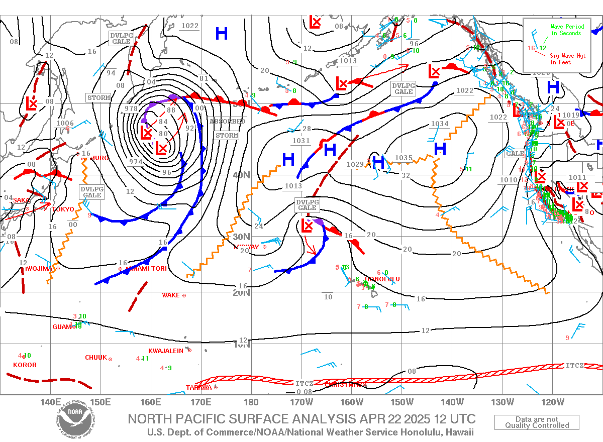
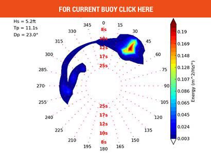
Recent/Now/Next: Surf on Sunday was 1-2’+ Hawaiians scale on a dropping, 11-13 second period, NNW swell. The source was a large, quasi-stationary low over the western Bering Sea that aimed a short fetch of 35-45mph winds at the islands Apr 22. The swell peaked locally overnight Friday at 3-3.5’ at 13 seconds, enough for 2-4’ waves. Surf should drop to 1-2’ on Monday and become mostly flat for Tuesday through Friday with trade wind swell wrap taking over as the dominant source of surf.
Next: A fairly large system will develop over the NW corner of the North Pacific Apr 29-30. Winds aimed at Hawaii should increase to 35-45mph along a wide but short fetch and generate seas of 20-24’. Proximity will limit surf potential. Medium to long period forerunners of 16-17 seconds from the NW-NNW should arrive late Friday afternoon. Surf should rise to 2-3’ Saturday morning and peak in the afternoon at 2-3’+. Surf will drop to 1-3’ Sunday morning and 1-2’+ Sunday afternoon.
Finally: A very similarly looking storm will follow a nearly identical path May 1-2. This system will be slightly weaker but originating further south, meaning that the surf potential looks very similar, potentially slightly better. Long period forerunners of 17-18 seconds from the NW should arrive overnight Sunday. Surf should rise to 2-3’+ Monday morning and 2-4’ in the afternoon. It should drop to 2-3’+ early Tuesday.
Outlook: A whole bunch of nothing is in store May 3-6, which spells flat, summery conditions for the second week of May. The ECMWF model spins something up May 6-7 that could bring small surf towards May 8, but the GFS model depicts nada until May 9-10. These mixed signals amount to low confidence in surf potential locally after May 7, though there is certainly nothing large in the outlook.
South and West Shores: The South Pacific ramping up, even more strongly in the long range…
Recent/Now: Surf on Sunday was 1-occ. near 2’ on a 12-13 second period SSW swell. The source was a very long, wide fetch of 30-40mph winds south of New Zealand towards the ENE Apr 19-20, which is not very good aim. The lighter fetch winds support the shorter swell period. Surf from this source should fade into Monday.
Next: A trough passed south of the Tasman Sea and New Zealand Apr 20-21 that carried a 35-45mph fetch of winds aimed to the NE-ENE. A substantial portion of the seas were initially blocked by New Zealand, but the fetch gained some equatorward extent as it tracked away from New Zealand and into the central South Pacific Apr 23-25. 16-17 second period energy from the SW-SSW should arrive Monday. It should bring surf to above the background level Tuesday and Wednesday at 1-2’ occ. +. The swell angle should shift South midweek, and surf should lower to 1-occ 2’ on Thursday.
Next: A long, wide fetch of 40-50mph winds associated with a longwave trough will fill into the Tasman Sea Apr 24-25. 18-19 second period forerunners from the SW should arrive late Thursday. It should keep surf at 1-occ. 2’ on Friday and Saturday and drop on Sunday.
Finally: A compact, but powerful storm developed 1,200nm ESE of New Zealand late Apr 28. It will take an ENE track with winds of 45-60mph aimed to the NNE-NE as it tracked outside of the Hawaii swell window. Seas should reach to near 36-40’ on Monday, though the highest seas will be aimed east of Hawaii. Very long period forerunners of 20-22 seconds from the South should arrive on Saturday. Surf could rise to 1-2’ occ. + before dark. Surf should peak mid-late Sunday at 2-3’ occ. + and drop to 1-2’ occ 3’ early Monday and 1-2’ occ. + early Tuesday.
Outlook: Models depict a very large cyclonic gyre setting up SE of New Zealand May 1-5 that could deliver the largest SSW swell so far this season. A large area of 45-55mph winds could be captured NE from south of New Zealand, boosting seas to over 40’, and bring a prolonged period of surf above the summer average (2-4’ occ. +) May 8-12.
East Shores: Rising, bumpy trade wind swell this week…
Recent/Now/Finally: Surf on Sunday steadily dropped to 1-2’+ by the afternoon as the local and upstream trade winds eased. Heights should hold at 1-2’ for Monday and Tuesday due to fresh-paced trades upstream of the islands. By midweek, the local trades will strengthen, and surf should rise to 1-2’+ by late Wednesday, 1-3’ on Thursday, and 2-3’ on Friday, and 2-3’+ for the weekend and Monday.
Outlook: There is high confidence that the subtropical ridge will remain in place into mid-May. This translates to persistent, bumpy, near average (1-3’) surf.
The next full SNN Big Picture will be issued on Sunday, May 5.
Forecaster Jonathan Huynh
Surf Climatology HERE


