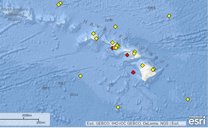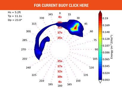
BUOY LINE-UP PER SHORELINE EXPOSURE (including spectral: the distribution of power/period in the total wave energy field/spectrum)
NW EXPOSURES (National Data Buoy Center)
51000 North Hawaii -245 Nautical Miles NE of Kauai + Spectral Density
51001 NW#1 -188 Nautical Miles NW of Kauai + Spectral Density
51101 NW#2 -186 Nautical Miles NW of Kauai + Spectral Density
51208 Hanalei -4 miles off Haena Pt. moored 800ft deep + Spectral Density
51201 Waimea + Spectral Density
Waimea Bay (PacIOOS) (4 miles offshore & moored 600ft deep)
WINDWARD EXPOSURES
51202 Kailua (Mokapu) + Spectral Density
51207 Kaneohe Bay + Spectral Density
51205 Pauwela just off NS Maui + Spectral Density
51206 Hilo Bay + Spectral Density
SOUTHERN EXPOSURES
Kalaeloa ‘Barbers Point’ (NBDC) + Spectral Density
Kalaeloa ‘Barbers Point’ (This PacIOOS wave buoy sits 1.7 miles offshore of Kalaeloa Harbor on the leeward (western) coast of Oʻahu & is moored 291 meters deep).
Lana’i (NOAA)+ Spectral Density Graph (The PacIOOS wave buoy Sits 2.5 miles SW of Kaumalapau Harbor off the southwest coast of Lānaʻi & is moored 784 feet deep).
51211 – Pearl Harbor Entrance +NDBC Spectral Density + PacIOOS Spectral Model
Note: Direction of swell at Pearl Harbor skews SSE due to the refraction of SSW swell in the shallow water placement of buoy.
51003 W. HI. -205 NM SW Hono + Spectral Density
51002 SW -215 NM SSW Hilo + Spectral Density
51004 SE -185 NM S/E Hilo + Spectral Density
51209 – American Samoa + Spectral Density+ PacIoos Wave Obs (3-4 day travel to Hawaii) MAP HERE
 |
|
| 51004 |
|
| 51001 last 48 hours (broadband recommended) |
|
51003 |
|
| 51002 |
|
| 51201 Waimea | |
| 51202 Kailua Buoy | |


